


No items found.
The Most Comprehensive Parcel Data Available
From nationwide property ownership to boundary details, Land id® provides valuable data for land owners, real estate agents, and industry professionals for many purposes and needs.

Owner Name, Addresses, Acreage & Land Info
Land id® is the best option for exploring and building parcel maps online that benefit from having the most extensive dataset available. Build maps faster and share them with your audience in minutes.
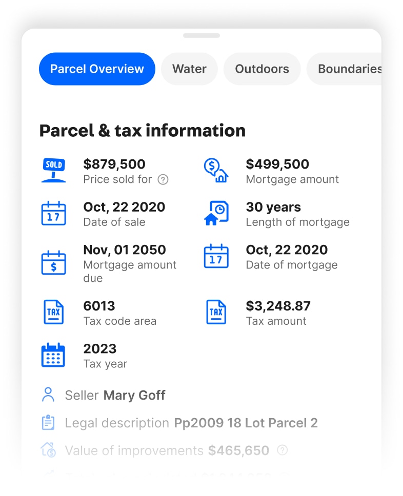
Mortgage & Assessment Information
Property ownership information provides critical insights for real estate investments. Knowing the owner and their mailing address can help initiate contact, while verifying property boundaries can ensure accurate property assessment and valuation.
Building Details
Identifying a property's building details is essential for assessing its value, potential for renovation, and overall condition. Land id® helps make informed decisions about real estate investments, maximizing their potential value.


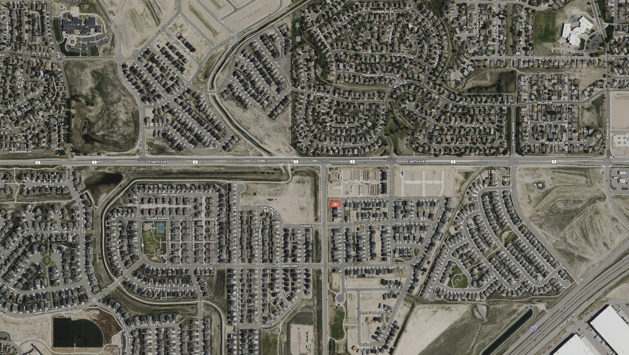


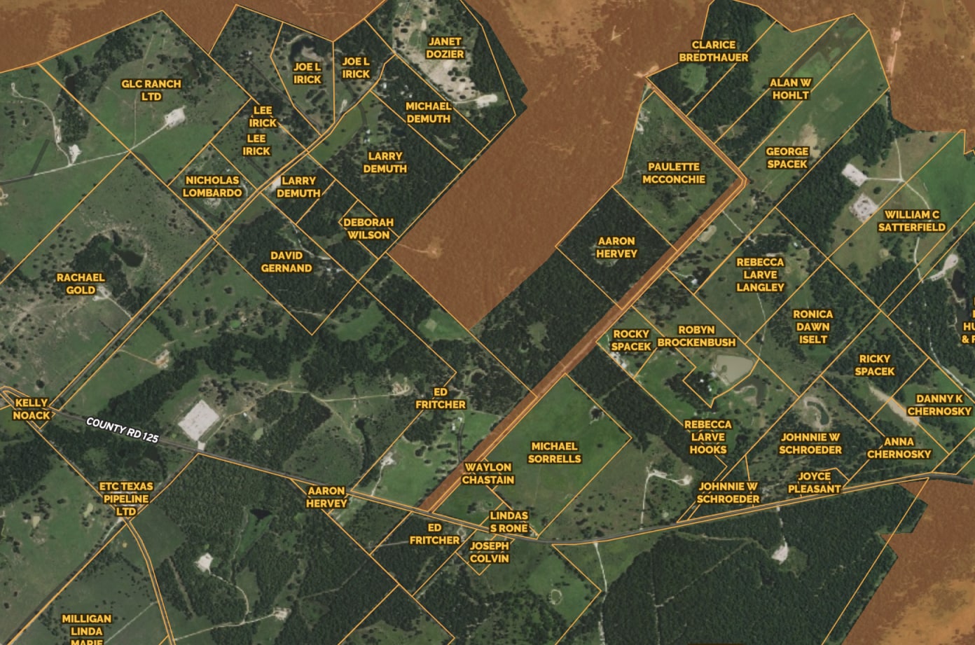


Access Nationwide Land Owner & Property Line Info
Make informed decisions with our Parcel layer. Get detailed information about land parcels, including ownership, zoning, and property boundaries. Easily search parcels by APN number or landowner name, and extract mailing lists from landowner addresses.
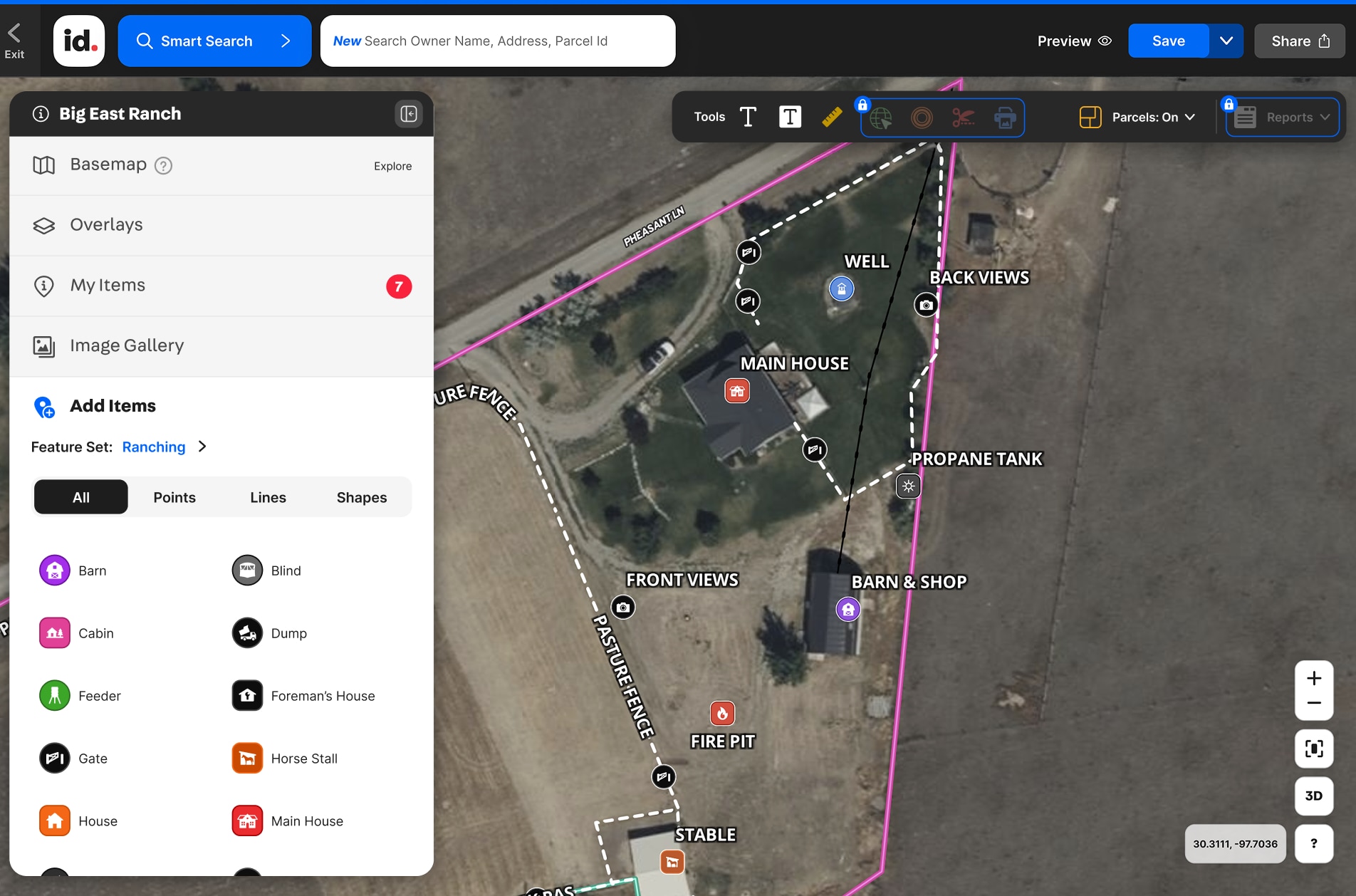
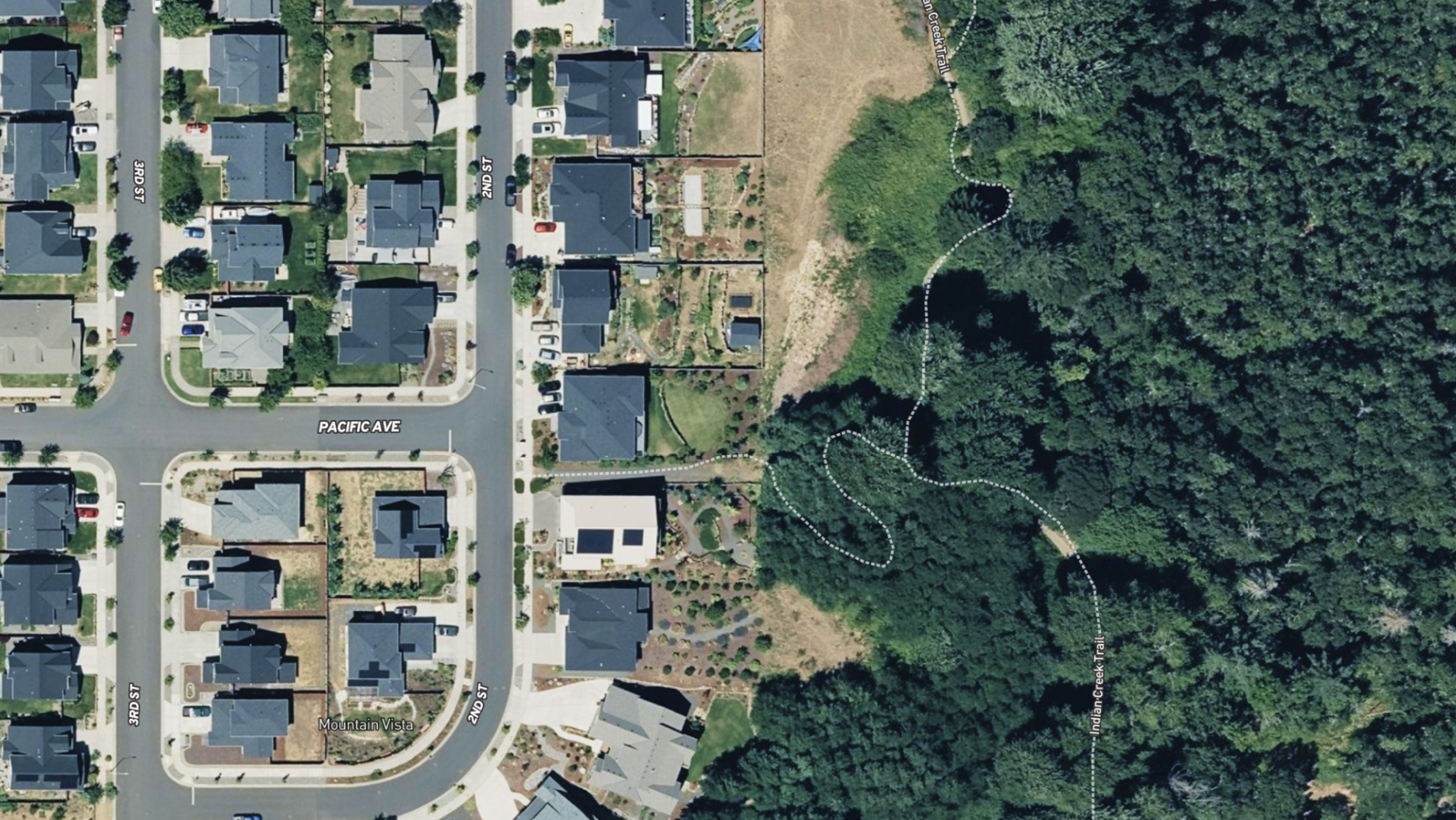
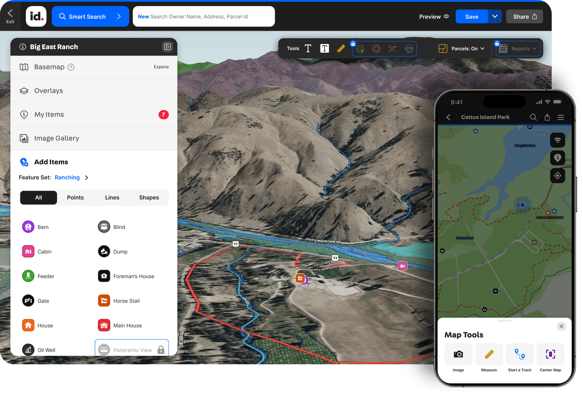
Add Contextual Notes & Labels
Show your property expertise and help viewers make smarter decisions. Labels, icons, and contextual notes help viewers gain a better spatial understanding of crucial aspects of a property.
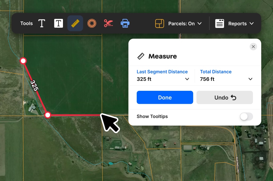
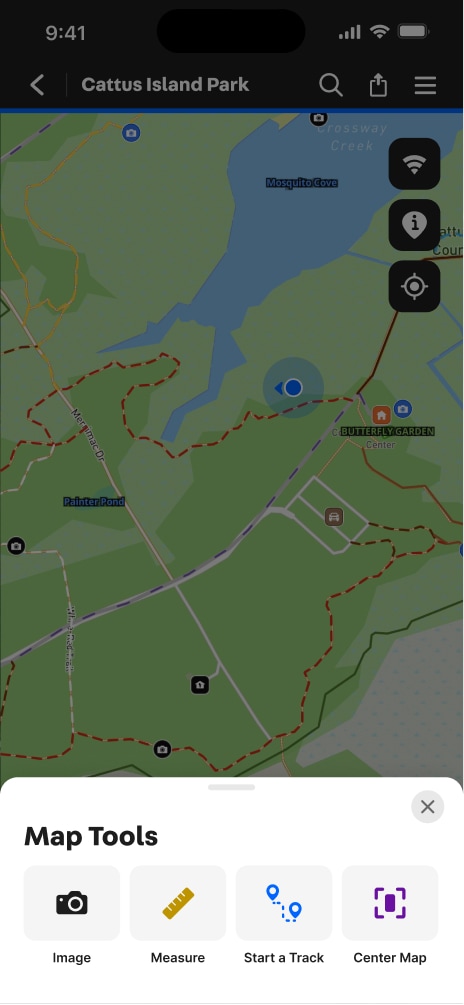
Measure Anything Easily & Precisely
Eliminate eyeballing and guesswork with easy-to-use measurement tools. Draw shapes, create land boundaries, and precisely measure distances right from your desktop or phone.

Explore Private Parcel Data & Property Boundaries
Download the Land id app and try for free.

Make Your First Map in 3 Min.
Try for free
Land id®
Normal

Experience Land id® Overlays
Try it For Yourself
Select a tab below to explore Land id® map overlays and uncover hidden details of the land. Discover the wealth of information that lies beneath the surface.

Thank you! Your submission has been received!
Oops! Something went wrong while submitting the form.

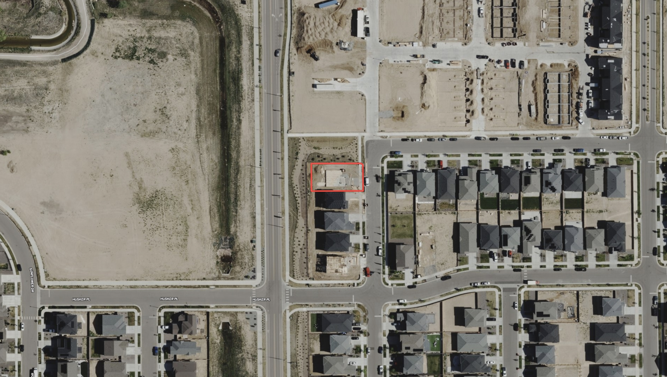
Private Parcels
View private parcel information and property lines.
Parcels

Wetlands
USFW-managed inventory cataloging nationwide wetland details.
Water

Water Wells
Well locations registered with their respective state water well management authority.
Water

Surface Water
Hydrological features such as rivers, lakes, reservoirs, and groundwater.
Water

FEMA Floodplain
Pinpoints flood-prone zones, guiding planning and insurance rates.
Water

Contour Lines
Maps elevation changes, connecting points of equal height for geographic topography
Outdoors

Fed/State Land
Govt. owned, managed by agencies for public recreation, conservation, & resource management.
Outdoors

Summits and Gaps
Peaks: High points. Gaps: Low passes between mountains.
Outdoors

Land Use
A County’s assessment of a property purpose for taxation. Land Use is not zoning.
Boundaries

City Limits
Boundary marking a city's legal extent and jurisdiction, excluding areas beyond.
Boundaries

County Lines
Geographical boundaries demarcating county jurisdiction.
Boundaries

FSA CLU
Streamlined land units for efficient farm management and government support.
Boundaries

Soil Overlay
Earth's surface mix of minerals, organics, water, and air.
Soils

Oil Wells
Oil & Natural Gas Wells from the Homeland Infrastructure Foundation-Level
Infrastructure
Transmission Lines
Details on high-voltage electrical lines: location, characteristics, attributes.
Infrastructure

Substations
Info on substation location, capacity, and attributes.
Infrastructure

Pipelines
Comprehensive info on state's pipelines: location, capacity, substances transported.
Infrastructure

Housing Devs.
View all active projects being conducted by the top 350 homebuilders in the US.
Nearby

Points of Interest
USGS-curated layer with names & locations of two million+ features across the US.
Nearby

Wilderness Areas
Displays federally protected lands managed for preservation and minimal human impact.
Nearby

Fiber Optic Service
Shows current and future planned fiber internet availability.
Infrastructure


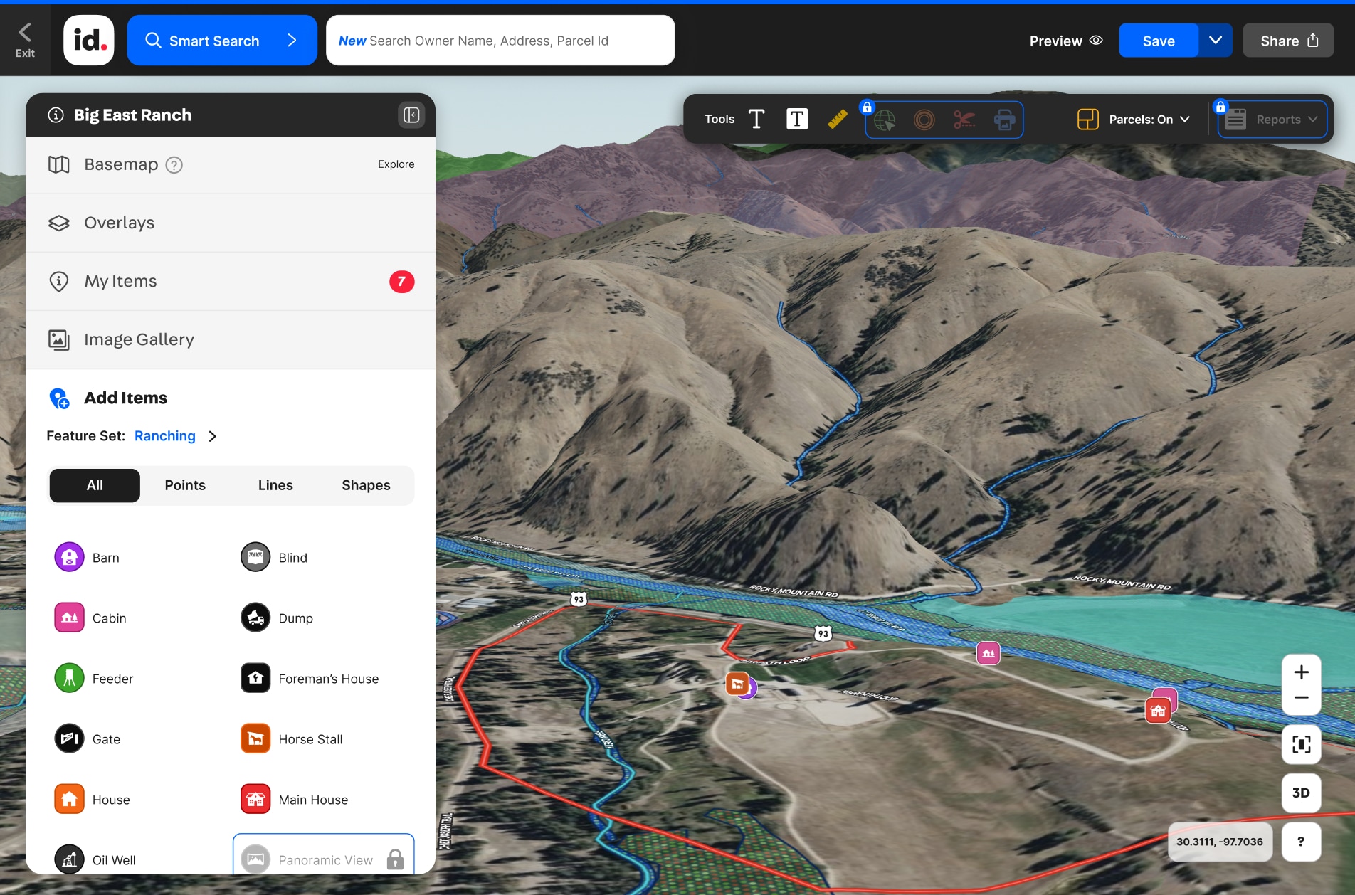
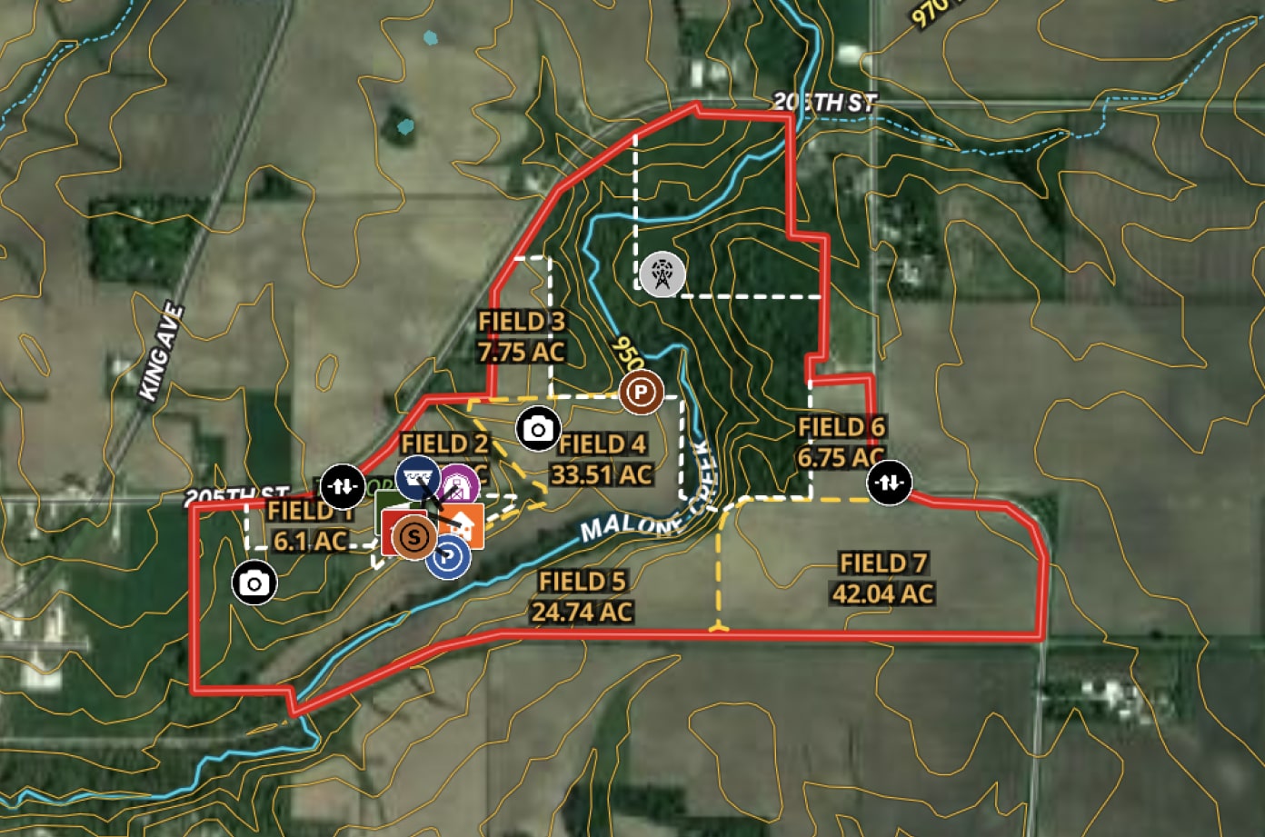
Identify Your Land
Easily Create & Share Maps
Creating and sharing visually stunning and informative property maps has never been easier. Try Land id® for free today.

No items found.
No items found.
Make Your First Map in 3 Min.
Try for freeExplore Private Parcel Data & Property Boundaries
Download the Land id app and try for free.
Testimonials
I use Land id on every buyer and seller that I work with. Simply providing a map to every person through the process helps with all aspects - getting measurements of the property, helping the photographer know property boundaries, verifying property features and attributes, marketing those features, showing property with the buyer's agent, using the tool for property tours and giving a unique map to the buyer.

Megan Turnipseed
ALC, Broker Associate, Keller Williams Realty Lone Star
No items found.

Custom Maps at Your Fingertips
Premium Creation Tools for Mapping Properties
Turn property details into stunning maps that are easy to create and ready to share.
Custom Maps at Your Fingertips
Premium Creation Tools for Mapping Properties
Turn property details into stunning maps that are easy to create and ready to share.


Fast, Flexible Map Sharing
Share Custom Maps Instantly With Anyone
Quickly share your custom maps with family, clients, team members, or stakeholders—no downloads required and no hassle! Land id® automatically updates your shared maps everywhere when you make edits.
Explore Private Parcel Data & Property Boundaries
Download the Land id app and try for free.
Make Your First Map in 3 Min.
Try for free
Demo request received.
One of our experts will reach out shortly to schedule your demo.
Oops! Something went wrong while submitting the form.
Make Your First Map in 3 Min.
Try for freeFAQs
No items found.
Explore Private Parcel Data & Property Boundaries
Download the Land id app and try for free.
