

Whether it be studying the world’s geography, getting directions to the supermarket, or checking the elevation of a hike, we use maps on a daily basis—often, without even realizing it. Due to their ubiquity, we don’t tend to give a second thought to using maps, but a lot goes into creating these visual depictions of the world around us.
Cartographers, the creators of our maps, have to pull from earth science, geography, topology, and even politics, relate all of those things back to location, then visualize them in a way that readers can easily comprehend. When done well, the maps they create help us understand where we are, analyze spatial relationships, and navigate our increasingly complex world.
The practice of cartography has been around almost as long as humans have, and over this lengthy period of time, the cartography tools mapmakers use have evolved quite a bit. While today we can rely on aerial photography, remote sensors, satellites, GPS, and GIS, our mapmaking predecessors didn’t have that luxury. Even so, they made do with what they had and created some truly incredible depictions of our world.
Early Maps
The oldest map known to humankind may date all the way back to the period between 7000 BC and 6001 BC. This ancient map, painted on the wall of a cave, is said to portray the Anatolian city, Çatalhöyük—depending on who you ask. Some believe the 9-foot-wide map illustrates a volcano and 80 ancient buildings, while others say the image is merely a geometric art piece and not a map at all.
The next known map (or the first depending on if you count the previously-mentioned cave painting) was made in 600 BC Babylon on a clay tablet. Many think this map represented the mythological places the Babylonians believed in at the time, including the connection between Earth and the heavenly realms.
Shortly after, a Greek philosopher by the name of Anaximander was credited by many with creating the first world map. This circular map depicted the known regions of the world at the time surrounded by the ocean.
The Cartography Tools of Our Past
While early maps were far from reliable—Anaximander’s map, for instance, depicted the world as a cylinder with the inhabited world situated on top—they grew increasingly accurate as time went on. This was in large part due to the invention and advancement of cartography tools.
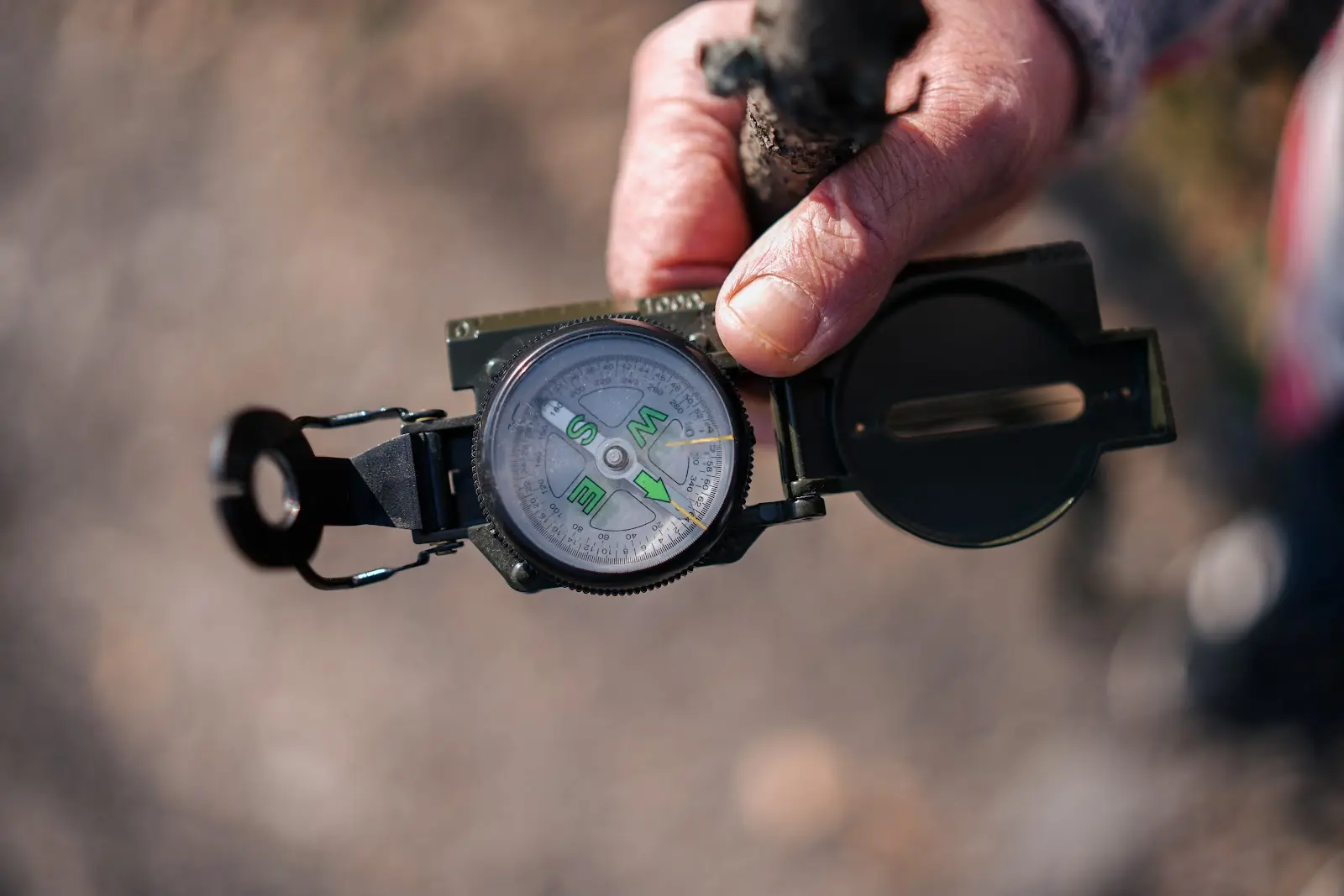
Compass
When most people think of a compass, they’re thinking of a magnetic compass. These cartography tools contain a magnetized needle that rotates so the ends point to the north and south. We don’t know where the idea originated from, but we do know that ancient Greek and Chinese scientists understood the principles of magnetism. 1st-century Chinese scientists likely even knew that rubbing a piece of metal against a lodestone (a natural magnet) would temporarily magnetize the metal.
Early compasses were primarily used as backup when the stars, sun, or other landmarks could not be seen, but as they became more reliable, their main purpose shifted to navigation. Most historians believe this shift first occurred in 11th or 12th century China, but shortly after (at the close of the 12th century), Western Europeans began using the compass for navigation as well.
Telescope
We can’t be entirely sure who first invented the telescope, but there are three main contenders. Dutch eyeglass-maker Hans Lippershey was the first to apply for a patent for his invention, which he called a kijker (“looker”). According to Lippershey, this telescope could successfully magnify up to three times. However, many claim Lippershey stole the idea from another glass worker from the same town, Zacharias Jansen. And a few weeks later, yet another Dutchman by the name of Jacob Metius filed a patent for his telescope as well. (Both patents were ultimately rejected because the designs were believed to be too easy to reproduce.)
Sextant
First produced by London’s John Bird in 1757, the sextant is one of the most influential cartography tools in history. Sextants measure the angle between two objects using a pair of mirrors and a movable arm, and they do so with impressive accuracy; sextants can measure an angle to the nearest ten seconds (1/360th of a degree). Originally, sextants were used to find longitude by measuring the angular distance between the moon and a nearby star, but they can also be used to find the angle between two earthly objects, making sextants a key instrument for triangulation.
Land id’s Modern Mapping Tools
While compasses and sextants make great additions to any cartographer’s arsenal of map making tools, they’re best used to supplement more modern mapping technology—namely, GIS. With Land id® (formerly MapRight), determining property lines, identifying key features, and presenting data is easier than ever.
To start, you can plot out the degrees and distance calls of each boundary for a property in minutes, easily overlay surveys and site plans with our georeference tool, and personalize your map with labels, icons, images, and videos. But that’s not all. You can also toggle on over two dozen Land id layers to get a more complete understanding of the land (and if we don’t have the data you’re looking for, you can always upload your own).
So, are you ready for an intuitive, modern map-making experience? Sign up for your free trial of Land id today!
FAQs
Continue Reading
Make the Most of Selling Season, Part 1: Win More Listings
By Land id
Part 1 of 3 in our "Make the Most of Selling Season" series helps you walk into every listing appointment ready to win.

No Boundaries: Strategic Growth Leads Engel & Völkers From Overseas to Land id
By Land id
Discover how Engel & Völkers uses Land id's mapping and property intelligence tools to support land, ranch, and residential agents across the US.


Explore Private Parcel Data & Property Boundaries
Download the Land id app and try for free.
